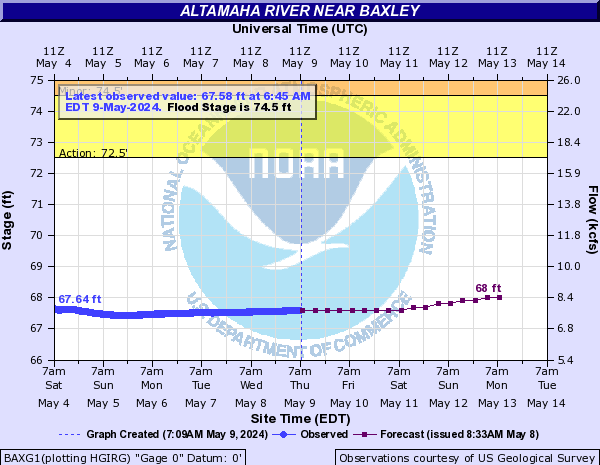
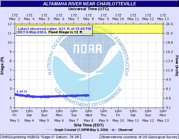
Altamaha River
The 137-mile Altamaha River is one of the great natural treasures of the eastern United States. Pronounced Al’ta’mahaw’ the river starts at the confluence of the Ocmulgee and the Oconee Rivers near Hazelhurst and flows undammed to the Atlantic Ocean in Darien.
Crossed by roads only five times, the largely undisturbed river is believed to be more than 20 million years old and pumps an average of 100,000 gallons of fresh water into the sea every second, making it the third largest contributor of fresh water along the eastern seaboard.
The Altamaha’s watershed (drainage basin) is approximately 14,000 square miles, qualifying it as one of the largest river basins in the United States. Including its tributaries (Ocmulgee being the largest) the United States Geological Service records the length of the river at 470miles, and all found within the state of Georgia.
Stay on top of the Altamaha Riverkeeper news!
Sign Up to the ARK Newsletter to receive our email alerts about Altamaha Riverkeeper news and views.
Altamaha River Recreation Map
Altamaha River Water Safety Map
Altamaha River Outfitters:
- On The Fly Outfitters (912) 342-7086 https://www.ontheflyoutfitters.co
- Canoe Canoe Outfitters (912) 786-8732 http://www.canoecanoe.com/river-trips/altamaha-river/
- Three Rivers Outdoors (912) 594-8379 http://www.3riversoutdoors.net
- South East Adventure Outfitters (912) 638-6732 http://southeastadventure.com
- Altamaha Coastal Tours (912) 437-6010 http://www.altamaha.com
- Kingfisher Paddleventures (912) 602-2470 https://kfpaddle.com
- Golden Isles Paddle Company (912) 602-2470 https://gipaddle.com
- Bracewell Charters (912) 996-1572 https://www.bracewellcharters.com
- Capt Gabby (912) 270 5383
http://www.captgabby.com/
Altamaha River Fishing Guides:
- Southeastern Angling (912) 270-7300 https://www.captainscottowens.com
- Georgia Charter Fishing (912) 617-1980 http://georgiacharterfishing.com
- The Georgia Fishing Company (912) 617-5577 https://www.charterfish.com
- Georgia Saltwater Adventures (912) 483-3500 https://www.georgiasaltwateradventures.com
- Cap Fendig Tours (912) 399-5007 http://www.capfendig.com/stsimonsfishing.html
- Coastal Tide Excursions (912) 602-1677 http://www.shrimpcruise.com/charter-fishing.html
- Billy Bee’s Family Charters (912) 269-9983 https://www.billybeecharters.com
- Jaybird Fishing Charters (912) 230-2473
- Coastal Georgia Inshore Charters (912) 230-1814 https://fishthegeorgiacoast.com
- Fly Cast Charters (706) 540-1276 http://flycastcharters.com
- Island Angler Charters (912) 399-3174 https://islandanglercharters.net
- Creekside Charters (912) 571 6322 https://stsimonsfishingguides.com
- Coastal Outdoors Adventures (912) 223-7173 https://www.coastaloutdooradventures.com
- Golden Isles Fishing Company (912) 222-0684 https://www.goldenislesfishingcompany.com
- Coastal Expeditions (912) 270-3526 http://coastalcharterfishing.com
- Island Lure Charters (912) 266-7176 https://fishthegoldenisles.com/captain.html
- Hook and Knife Charters (912) 399-3813 https://hookandknifecharters.com
- Liquid Asset Fishing (912) 264-8860 http://www.liquidassetfishing.com
- Captain Griffin Wood (912) 269-7337 http://www.captaingriffinwood.com
- Georgia Light Tackle (912) 585-1593 https://www.georgialighttackle.com
- Shallow Water Pursuits (912) 266-7567 https://www.shallowwaterpursuits.com
- Salt Coast Outfitters (912) 222-2603
There are so many ways that you can help keep our rivers clean and beautiful. Responding to Action Alerts or reaching out to your elected representatives. Find your way to get involved!


